We move on tonight to the second word of the Hanukkah phrase “gadol” – large, great. There aren’t many places in Israel which include “Gadol” in their name. In fact, I could only find one. The paucity of places doesn’t take away from this unique example, because it’s really big, much bigger than a town or even a city. It’s a very special geological formation – a makhtesh – makhtesh HaGadol!
Although similar in appearance to a crater, a makhtesh is not formed by an impact of a celestial object in the earth’s crust. The unique look of a makhtesh is created through erosion. Several factors are necessary for a makhtesh to form. First and foremost, there must be a layer of hard stone on top of a soft stone. Hard stones include limestone, dolomite, etc. while soft stones are chalk, sandstone, etc. The hard stones serve as a kind of crust over the soft ones like the crust that covers a loaf of bread.
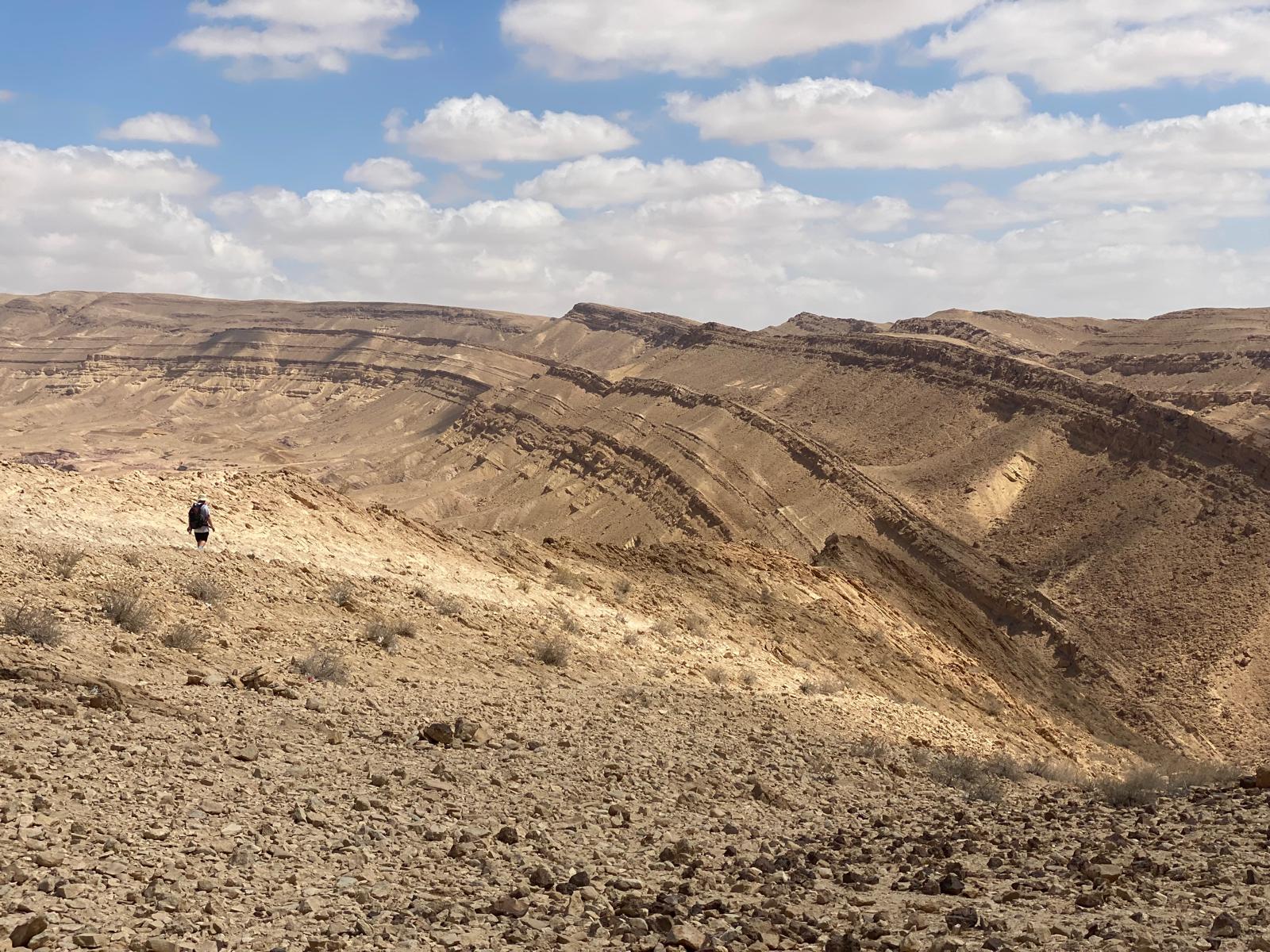
When rain falls, small fissures form in the crust and form channels. At the same time, tectonic activity tilts the landscape, lowering one side and directing the water to flow in this direction. As these water channels deepen, they arrive at the soft rock inside and swiftly (in geological time) erode them. The lowest, weakest point bursts open to allow the water to flow out, carrying with it the soft stone. With the inside gone, soon enough the crust of the landscape collapses, forming sheer cliff walls. Additional water that falls only serves to deepen the makhtesh.
The unique geology of the Negev, with its thick layers of sedimentary rocks of different types, with hard rocks on top of soft ones, serves as the first requirement for the formation of a makhtesh. The second requirement for tectonic activity is provided by the Syrian African Rift – the same fissure that created the depression for the Sea of Galilee, the Jordan, and the Dead Sea. The Syrian African Rift lowered the eastern side of the makhtesh and gave a direction for the water to exit and become a nahal (stream) – Nahal Hatira.
Makhtesh HaGadol is the second largest makhtesh in Israel, and indeed in the world, measuring 14 km x 6 km (8.5 miles x nearly 4 miles) and reaching a depth of 450 m (1475 ft). The requirements for formation of a makhtesh only exist in the Negev and the Sinai peninsula giving rise to less than 10 makhteshim in the whole world! The lowest layer of rock that is exposed was laid down about 200 million years ago and there are fossilized trees found within the makhtesh.
During the British Mandate, the Makhtesh HaGadol was the site of an exploratory mining operation. The British, in their every present quest to control the source of oil, looked for the liquid in the Makhtesh HaGadol to no avail. Their 2 exploratory holes (Lucky 1 and Lucky 2) did not produce any oil, but did open the door to exploration in the area. They were the first to see this wonder of nature, and discover a natural path through the desert landscape (once you found a way over the initial drop).
Because of the shifting of the layers due to the rift, and the collapse of the upper crust of the area, fins of rock are seen on the eastern edges of the makhtesh. One of these gives its name to a hiking trail “The Big Fin” along this formation, with beautiful vistas. I hiked a similar trail, “The Small Fin” recently with my grandchildren and we got to discover this “only in Israel” phenomenon for ourselves.

Leave a comment